Black Oak Heritage Park

a landscape view of Black Oak Heritage Park
Between Broadway Street and Cherry Blossom Avenue, just west of Ojibway Park

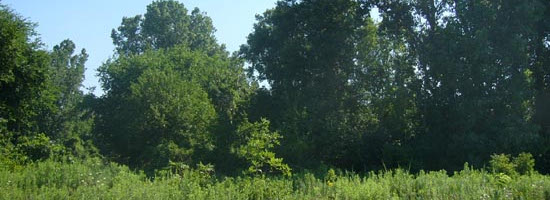
Black Oak Heritage Park supports one of the finest stands of black oak in Southwestern Ontario and is home to such nesting birds as Scarlet Tanager, Rose-breasted Grosbeak, Eastern Bluebird and Cooper's Hawk. Many of the native plants at Black Oak Heritage Park are extremely rare elsewhere in Canada. Black Oak Park is part of the Ojibway Prairie Complex, which also includes Ojibway Park, Tallgrass Prairie Heritage Park, Spring Garden Natural Area and Ojibway Prairie Provinical Nature Reserve.

Black Oak Heritage Park - Frequently Asked Questions

What is Black Oak Heritage Park?

Black Oak Heritage Park (BOHP) - an ecological gem in the City of Windsor - is a natural area of land, and public park area that is part of the Ojibway Prairie Complex in the City of Windsor. The area also includes Ojibway Park, Tallgrass Prairie Heritage Park, Spring Garden Natural Area and Ojibway Prairie Provincial Nature Reserve.  

What is unique about Black Oak Heritage Park, and why is it special to Windsor?

BOHP’s Black Oak savanna is one of the largest stands in Ontario. It is also one of the most endangered habitats in Canada. This unique natural area in the City of Windsor includes large, often old-growth trees – some 150 to 200 years old. In addition to the precious Black Oak savanna and Black Oak woodland, the area includes: some tallgrass prairie; native plants that are extremely rare all across Canada; a variety of large wildlife (deer, coyotes, foxes); rare butterflies like the Hackberry Emperor; nesting birds like the Scarlet Tanager, Acadian Flycatcher, Black Oak Cuckoo, Rose-breasted Grosbeak, Eastern Bluebird and Cooper’s Hawk. BOHP is a true haven for many of these birds that require large sections of unbroken forest to survive.

What is unique about the Ontario Prairie Complex, and why is it special to Windsor?

The most striking aspect of Ojibway Prairie Complex is the tremendous variety of its vegetation and animal life. Wetlands, forest, savanna and prairie provide habitat for a great number of rare plants, insects, reptiles, birds and mammals – including those listed above. The prairie landscape, characterized by a lack of trees (less than 2.5 trees / hectare) includes grasses and flowers that grow very tall and lush; hence the name – tallgrass prairie.

Essex County, in extreme southern Ontario, has less than 6% natural forest cover. It is estimated that less than 0.5% of the original prairies and savanna remain in all of Southwestern Ontario today. The largest relicts which survived were those on lands controlled by native aboriginal peoples, such as Walpole Island, and those wedged between the developed urban portions of Windsor and LaSalle - the Ojibway Prairie Complex.

What is the history of Black Oak Heritage Park?

Of the five natural areas which make up the Ojibway Prairie Complex, BOHP is located closest to the Detroit River. The park and surrounding lands have a rich cultural as well as natural history and heritage. Early explorers reported the presence of Huron Indian corn fields along this part of the river. By 1749, the French had settled here, their fields replacing those of the Hurons. Their farmsteads represent the first major European farming community in Southern Ontario. Originally referred to as Petite Côte (Little Coast), the site later became known as la Côte de Misère (The Coast of Misery) because the sandy soils lost their fertility and farming was no longer productive. Industrial development threatened the site up until 1989 when the land was acquired by the City of Windsor.

What is the size of Black Oak Heritage Park, and the surrounding area?

Collectively, the four sites – BOHP, Ojibway Park, Tallgrass Prairie Heritage Park, and Spring Garden Natural Area – make up a total of approximately 244 hectares (604 acres) of land, and are designated as the Ojibway Prairie Remnants Area of Natural and Scientific Interest (ANSI). The nearby Ontario Prairie Provincial Nature Reserve, owned by the Ontario Ministry of Natural Resources, adds more than 105 hectares (230 acres) of additional prairie and savanna. The total area is continually growing as the City of Windsor and the Ministry of Natural Resources acquire more land for protection and preservation. 

Who oversees Black Oak Heritage Park?

The Ojibway Nature Centre, part of the City of Windsor’s Department of Parks, Recreation & Culture, and Facilities looks after four of the five areas: Ojibway Park, Tallgrass Prairie Heritage Park, Black Oak Heritage Park, and Spring Garden Natural Area.

What amenities does Black Oak Heritage Park offer?

BOHP is a gem of eco-tourism, and a beautiful place to escape the hustle and bustle of city life to spend some time in the solitude of a natural area. BOHP amenities include:

  • Two kilometres of marked trails with opportunities for passive recreational activities such as hiking, bird-watching, photography and leisure cycling.
  • Adjacent dog park.

How do I access Black Oak Heritage Park?

BOHP can be accessed from the parking lot entrance at Broadway Boulevard. This lot provides the only access point to the area.

Are there useable Trails available at Black Oak Heritage Park for public enjoyment?

Yes. There is one designated, accessible public trail in the north section of BOHP. The trail is two kilometres long, marked by helpful wayfinding and interpretive signage, and offers opportunities for passive recreational activities such as hiking, bird-watching, photography and leisure cycling.

A second trail onsite is not accessible and not open to the public.

Why is the second trail closed to the public?

The south section of BOHP, and the trail that runs through it, is not available for public use. Any trails present there must be avoided. Use of such trails would be in violation of the City of Windsor’s Parks By-law (200-2002), which is in place to protect and preserve environmentally sensitive areas. Human interaction with such protected areas would jeopardize numerous rare and endangered species in the area. BOHP contains sensitive habitats, and is a natural community gem. As such, its protection and preservation is vital to maintain the land and the species that make their home there. These lands are protected in our community because something rare and important exists within them. The City of Windsor works to provide a balance between public access to appreciate and enjoy such lands, while protecting the area so that future generations can access them as well. 

What type of uses/activities does Black Oak Heritage Park accept/support?

The designated trail at BOHP is reserved for passive recreational activities only, such as hiking, bird watching, photography and leisure cycling.

What type of uses/activities are prohibited in Black Oak Heritage Park?

In order to protect and preserve BOHP and the numerous sensitive species and plant life that exist within it, the following uses / activities are prohibited in the park:

  • Motorized vehicles, including e-bikes.
  • Exploration / utilization of the trails on the south section of the park.
  • Exploration / utilization of the property owned by the Windsor Port Authority along the park’s western boundary.
  • Any alteration to the physical land (i.e. digging or creating trails, building structures, etc.).
  • Removing any items from the park (i.e. leaves, sticks, stones, dirty, plants, etc.); while tempting to take home a keepsake, everything found in BOHP has a purpose – we encourage you to leave everything behind for someone else to enjoy, and take pictures and memories away after your visit.

What can I do if I see someone abusing Black Oak Heritage Park?

To help preserve and protect BOHP, please report any unauthorized uses / activities to 311.

Black Oak Heritage Park was closed from December 2015 to April 2018; what was the cause of this closure?

BOHP closed to the public in 2015 to accommodate construction and development of the Herb Gray Parkway. The project required the closure of the parking lot entrance at Broadway Boulevard, which provides the only access point to the park. As a result, public access to the area was not possible during the project phase. Now that access to Broadway Boulevard has been re-established, visitors are once again able to enter and enjoy BOHP from dawn to dusk.

Will Black Oak Heritage Park be closed to the public again at any point in the future?

Construction and development of the site of the Canadian Port of Entry for the Gordie Howe International Bridge, adjacent to BOHP, is now underway. As this latest project progresses, temporary closures for Broadway Boulevard and BOHP may occur from time to time. During these times, access to the park may be affected. All members of the public are required to keep out of the construction site during such times - for preservation of the land and for personal safety. Unauthorized entries during such times will be considered trespassing. Visit www.wdbridge.com for information on road closures, and www.citywindsor.ca for information on closures that may impact access to BOHP.

Why is it important to keep out of areas that are regenerating or closed to the public?

Many plants, animals, birds and insects - especially rare ones – can be displaced by human disturbance. Regeneration of a natural area is critical to the proper assessment of its habitats and species.

What is the future plan for the preservation/engagement of Black Oak Heritage Park?

The City of Windsor’s Parks Master Plan – Rediscover our Parks – lays out a 20-year vision (2015 to 2035) for the design and development of city park areas, including BOHP. The Parks Plan sets forth a Vision “to provide a robust parks and recreation experience for all to enjoy”, and a Mission “to sustainably develop and maintain parkland and recreational activities with our natural and cultural resources; foster economic growth within the city, while cultivating a quality of life for diverse, healthy, active and liveable neighbourhoods.”

BOHP is a key natural area included in the Parks Master Plan, with future plans for management of the land being looked at through a lens of accessibility and inclusivity, communication and partnership, healthy and wellness, sustainability, park diversity, connectivity, safety, efficiency and experiential tourism. Work in this area is slated to begin in 2018.

What is a Natural Area Management Plan, and how long does it take to complete?

A natural area management plan outlines features, uses, data, mapping, species at risk, invasive species, rare habitats, significant functions, and other important properties of a natural area. It also provides an analysis of surveys, mapping and uses of the natural area, along with recommendations for management, mitigation, and protection.

A natural area management plan provides the background information needed to make sound scientifically based management recommendations. It is developed by a qualified specialist, biologist, or ecologist with experience in the natural area and its featured habitats, functions and species. Depending on the complexity and size of the natural area, a management plan can take from one to several years to complete.

Additional Resources and Information:

Amenities

  • Dog Park
  • Parking
  • Walking Trails

Map Provided by Google 

MappMyCity Park Finder 

MappMyCity Park Finder

Playground and trees at Aboriginal Park

Aboriginal Park

View from AKO Park

AKO Park

a close shot of the alexander park area

Alexander Park

Landscape view of Alton C Parker Park

Alton C. Parker Park

Assumption North Park

Assumption Park Street View.JPG

Assumption Park

a landscape view of Atkinson Park

Atkinson Park

Avon Court Park trees and play unit

Avon Court Park

Avondale Playlot

Avondale Playlot

Balsamo Park

Balsamo Park

a landscape view of Bellewood Park

Bellewood Park

a landscape view of the Bert Weeks Memorial Gardens

Bert Weeks Memorial Gardens

a landscape view of Black Oak Heritage Park

Black Oak Heritage Park

Bradley Rollup

Bradley Park

a landscape view of Broadway Park

Broadway Park

Brock park waterfront pathway, geese and a picnic table

Brock Park

Brookview Park

Bruce Avenue Park Google Street View

Bruce Avenue Park

Brumpton Park pathway

Brumpton Park

Bush Park looking north

Bush Park

Vew of Cadillac Street Park

Cadillac Street Park

Play unit and buildings at Captain Wilson Park

Captain Wilson Park

Caron Avenue Park

Caron Avenue Park

a landscape view of Centennial Park

Centennial Park

a landscape view of Central Park

Central Park

Family Day at Charles Clark Square

Charles Clark Square Park

Chopin Park

Chopin Park

City Hall Square Park

City Hall Square Park

Civic Green Park - Tower of Freedom Monument

Civic Green Park

Civic Terrace

Civic Terrace Park

Clairview Bikeway

Clairview Bikeway

Clay Park

Clay Park

College Avenue Bikeway

College Avenue Bikeway

Compton Court Park

Compton Court Park

a landscape view of Cora Greenwood Park

Cora Greenwood Park

A close shot of the fountain and surrounding flowers in Conventry Gardens

Coventry Gardens

Crowley Park

Crowley Park

Curry Park

Curry Park

Curry Playlot

Curry Playlot

Dawson Park

Dawson Park

Derwent Park

Derwent Park

Devonshire Heights Park

Devonshire Heights Park

a landscape view of Dieppe Gardens

Dieppe Gardens

Dynasty Park

Dynasty Park

a close shot of the East End Park sign

East End Park

a landscape view of East Riverside Park

East Riverside Park

East Riverview Park

East Riverview Park

a landscape view of Lakeshore Woods

Elizabeth Kishkon Park (formerly Lakeshore Woods)

Esdras Park

Esdras Park

Map of Fazio Park neighbourhood

Fazio Park

Aerial view of Festival Plaza on the riverfront

Festival Plaza

Firgrove Boulevard Park

Firgrove Boulevard Park

Fontainbleau Park

Fontainebleau Park

group playing soccer at Ford Test Track

Ford Test Track

a view in Forest Glade Optimist Park

Forest Glade Optimist Park

Francois Court Park Google Street View

Francois Court Park

Ganatchio Park

Ganatchio Park

a close up shot of the Ganatchio Trail signage

Ganatchio Trail

Garry Dugal Park

Garry Dugal Park

Garwood Park

Garwood Park

Gateway Park Google Street View

Gateway Park

George Avenue Park

George Avenue Park

Gignac Park Google Street View

Gignac Park

Gino and Liz Marcus Park and Community Centre

Gino and Liz Marcus Park

Girardot Park

Girardot Park

Goldenwood Park

Goldenwood Park

Goose Bay Park

Grand Marais Drain Trail

Riverfront pathway at Great Wester Park with view of Detroit skyline

Great Western Park

Grove Park viewed from street

Grove Park

Street view of sidewalk corner at Hall Farm Park

Hall Farm Park

Street view of Hawthorne Park

Hawthorne Park

a landscape view of the Herb Gray Nature Reserve.  Includes a path and surrounding trees.

Herb Gray Nature Reserve

Concept sketch of Hiram Walker statue, passersby and trees

Hiram Walker Parkette

Street view of Homesite Park paths and play unit

Homesite Park

Street view of Howard Park

Howard Park

Street view of Huron Church Greenbelt

Huron Church Greenbelt

the gates at Jackson Park

Jackson Park

Pathway and play unit at Jennifer Park

Jennifer Park

a landscape view of the Joan and Clifford Hatch Wildflower Garden

Joan and Clifford Hatch Wildflower Garden

Street view of Kenilworth Park play unit

Kenilworth Park

Street view of Kennedy Square Park

Kennedy Square Park

Street view of snowy Kids Alliance Park

Kids Alliance Park

Street view of Kinsmen Chatham Street Park

Kinsmen Chatham Street Park

Street view of Kinsmen Norman Road Park

Kinsmen Norman Road Park

Map of

Kiwanis Park

Street view of Kominar Park

Kominar Park

Lake Como Park

Lake Como Park

Lake Grande Park

Lake Grande Park

Lake Laguna Park

Lake Laguna Park

Lake Trail Park

Lake Trail Park

Lakeview Park Marina

Lakeview Park Marina

Langlois Court Park looking east from South Pacific

Langlois Court Park

a landscape view of Lanspeary Park

Lanspeary Park

Leafield Park

Leafield Park

Legacy Park with riverfront view of Detroit skyline

Legacy Park

Lens Avenue Greenbelt

Lens Avenue Greenbelt

Little River Acres Park

Little River Acres Park

Little River Boulevard Park street view

Little River Boulevard Park

Pond and surrounding trees in the Little River Corridor

Little River Corridor

Little River Dragonfly Park 2021 Aerial Photo

Little River Dragonfly Park

Magnolia Park street view

Magnolia Park

a landscape view of Malder Park.  A group of cyclists along a curved path.

Malden Park

Maple Leaf Park street view

Maple Leaf Park

Marguriet Park

Marguriet Park

Mark Park street view

Mark Park

Mary E Bibb Park street view

Mary E. Bibb Park

Matchette Park street view

Matchett Park

Matthew Rodzik Park Google Maps Street View

Matthew Rodzik Park

Maurice Belanger street view

Maurice Belanger Park

Mayfair Park street view

Mayfair Park

McHugh Park Soccer Fields

McHugh Park

a landscape view of McKee Park

McKee Park

Meadowbrook Park Street View

Meadowbrook Park

a shot of the signage and surroundings at Mic Mac Park

Mic Mac Park

Mill Street Park Street View

Mill Street Park

a landscape view of Mitchell Park

Mitchell Park

Morningstar Park

North Merritt Park Street View

North Merritt Park

North Talbot Park Google Street View

North Talbot Park

North Tilston Park Google Street View

North Tilston Park

Oak Elm Park Google Street View

Oak Elm Park

Oakwood Park Google Street View

Oakwood Park

a landscape view of Ojibway Park

Ojibway Park

Ojibway Parkway Trail Google Street View

Ojibway Parkway Trail

a landscape view of Optimist Memorial Park

Optimist Memorial Park

Palmetto Park

Palmetto Park

Parent Park Google Street View

Parent Park

Parkwood Woodlot Google Street View

Parkwood Woodlot

Partington Park Google Street View

Partington Park

Paterson Park Google Street View

Paterson Park

Patrick Maguire Park Google Street View

Patrick Maguire Park

a shot of the Perennial Flower Garden

Paul Martin Gardens

a landscape view of the surrounding water and trees at Peche Island

Peche Island

Peche Island Landing Google Street View

Peche Island Landing Park

Pleasant Place Park (Reaume Park Overflow Parking)

Pleasant Place Park

Plymouth Park (2021 Aerial Photo)

Plymouth Park

Pykes Park Google Street View

Pykes Park

Radisson Bikeway Google Street View

Radisson Bikeway

Landscape view of Realtor Park

Realtor Park

a close shot of one of the walking trails in Reaume Park

Reaume Park

a landscape view of the Booster Pool and surrounding trees at the Remington Booster Park

Remington Booster Park

Riverdale Park Google Street View

Riverdale Park

Landscape view of a baseball diamond at the Riverside Baseball Park

Riverside Baseball Park

Riverside Kiwanis Park Google Street View

Riverside Kiwanis

Robert McDonald Park Google Street View

Robert McDonald Park

Robert Park Google Street View

Robert Park

Roseland Park Google Street View

Roseland Park

Roseville Garden Park Google Street View

Roseville Gardens Park

Walking trail off of the water at Sandpoint Park

Sandpoint Park

Senator Croll Park Google Street View

Senator Croll Park

Seneca Park Google Street View

Seneca Park

a shot of the area at Shanfield Shores

Shanfield Shores

Shawnee Park Google Street View

Shawnee Park

Shinglecreek Park 2021 Aerial Photo

Shinglecreek Park

Somme Park Google Street View

Somme Park

South Cameron Woodlot Treehouse Themed Accessible Play Unit

South Cameron Woodlot

South Merritt Park Google Street View

South Merritt Park

South Rendezvous Park Google Street View

South Rendezvous

Southdale Park Google Street View

Southdale Park

Southwood Lakes Trail Google Street View

Southwood Lakes Trail

Spring Garden Natural Area Google Street View

Spring Garden Natural Area

Springhollow Park Google Street View

Springhollow Park

St Paul Pumping Station Google Street View

St Paul Pumping Station Park

St. Paul Grove Park Google Street View

St. Paul Grove Park

St Rose Beach Google Street View

St. Rose Beach Park

Stodgell Park Google Street View

Stodgell Park

Stoneybrook Park Google Street View

Stoneybrook Park

a landscape view of Stop 26 Beach

Stop 26 Beach

Straith Park Google Street View

Straith Park

Superior Park Google Street View

Superior Park

a close shot of the signage at the Tallgrass Prairie Heritage Park

Tallgrass Prairie Heritage Park

Teedie Park Google Street View

Teedie Park

Thompson Park Google Street View

Thompson Park

Thurston Park Google Street View

Thurston Park

Tranby Park 2021 Air Photo

Tranby Park

Udine Park 2021 Air Photo

Udine Park

Unity Park Google Street View

Unity Park

a long shot of the surrounding trees in the Veterans' Memorial Park

Veterans' Memorial Park

Virginia Park Google Street View

Virginia Park

Vision Corridor Park Google Street View

Vision Corridor Park

a shot of the playground equipment and surrounding trees at the Walker Homesite Park

Walker Homesite Park

Walkerville Jubilee Park Google Street View

Walkerville Jubilee Park

Wellington Park Google Street View

Wellington Park

Westcott Park Google Street View

Westcott Park

WFCU Centre Google Street View

WFCU Centre

Whelpton Park Google Street View

Whelpton Park

a shot of the swingset in Wigle Park

Wigle Park

Wildwood Park Google Street View

Wildwood Park

a colorful representation in Willistead Park

Willistead Park

Wilson Park Google Street View

Wilson Park

a shot of an elephant monument at the Windsor Sculpture Park

Windsor Sculpture Park

Wolfe Lake Park Google Street View

Wolfe Lake Park