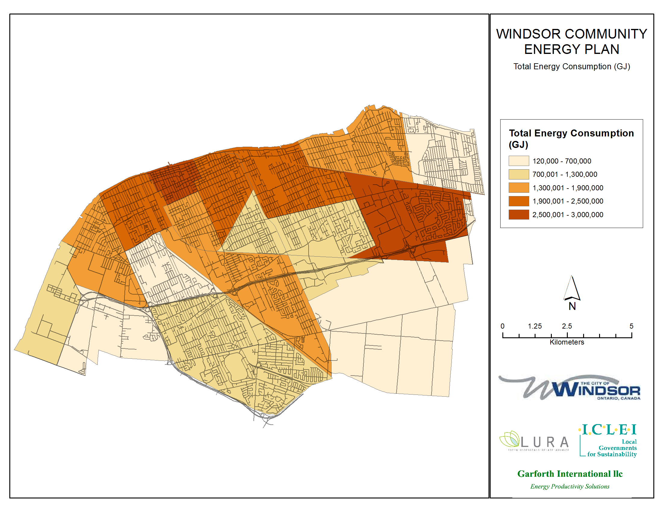
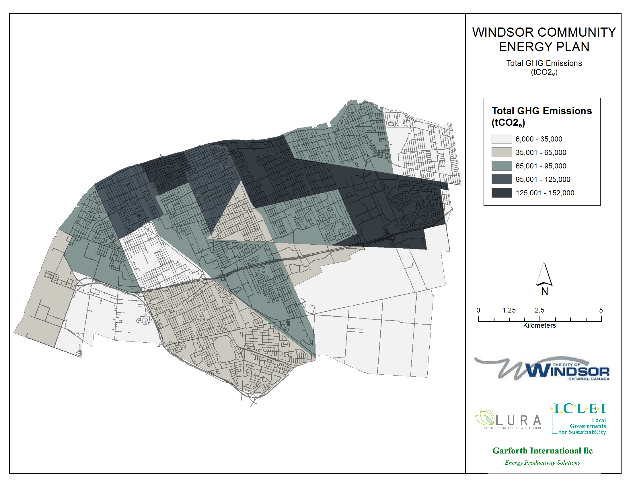
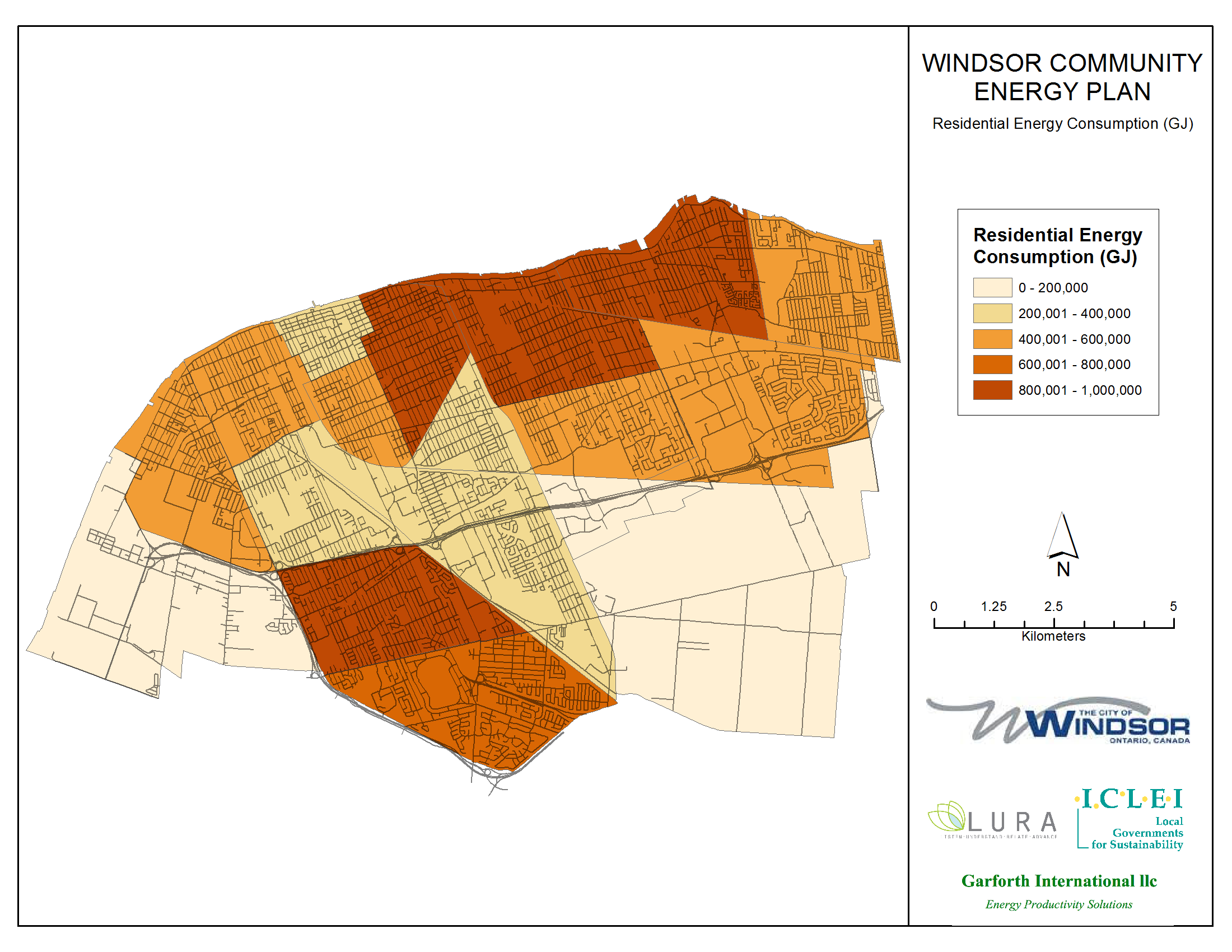
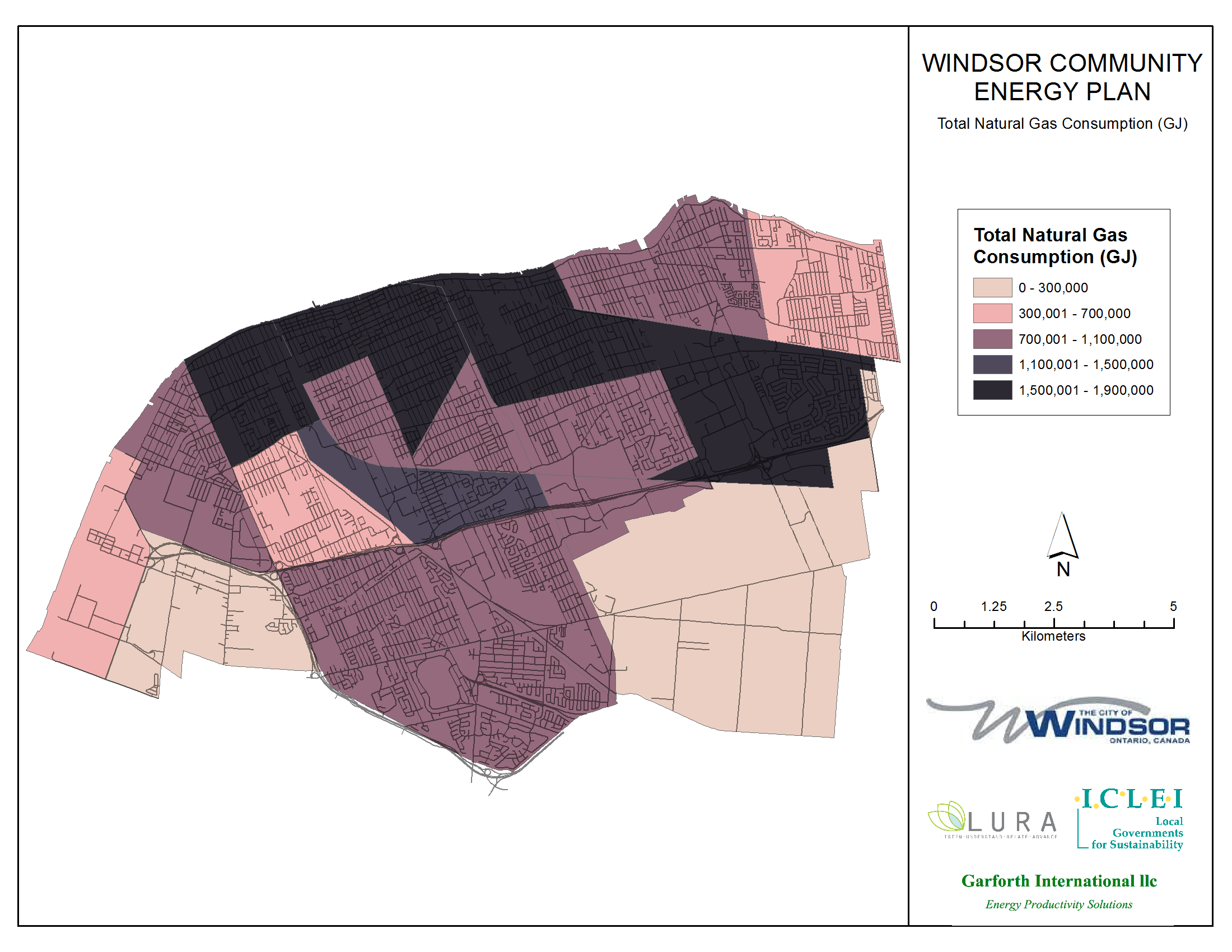
Energy Use Maps
Interested in how energy is used in your neighbourhood?
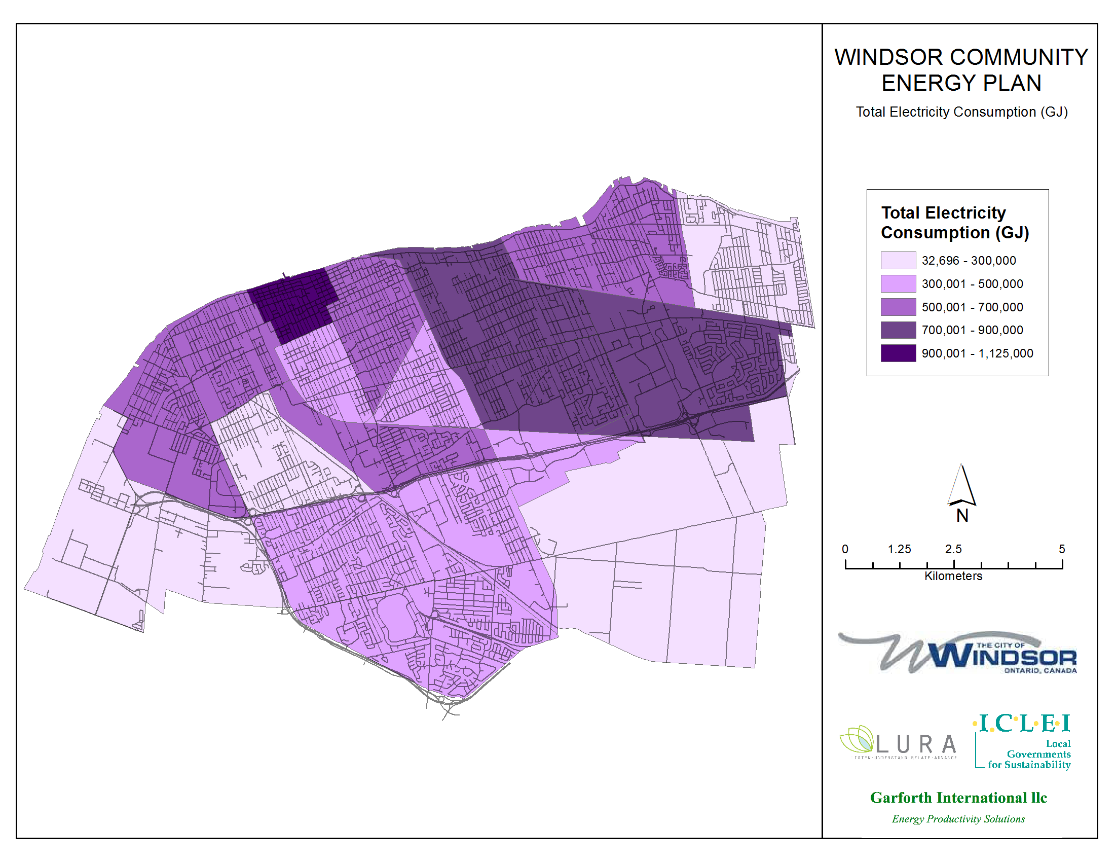
As part of the information collection and consolidation phase of the Community Energy Plan development process, a series of energy use maps have been produced depicting how energy is used throughout Windsor. Neighbourhood energy use is aggregated to prepare maps which depict use in energy planning zones, mirroring the planning zones used by the City's Planning Department. Using these maps, plan developers may identify priority areas and potential synergies.
Below is a sample of the maps which have been produced.
(Click on each map to expand.)
Total Energy Consumption
Total Greenhouse Gas Emissions
Residential Energy Consumption
Total Natural Gas Consumption
Total Electricity Consumption
For more information on Environmental Initiatives
Phone: For general information call 311. For detailed inquiries call 519-255-6100 ext. 6109.
Email: emp@citywindsor.ca