West Windsor Flood Assessment Study
West Windsor Flood Assessment Study
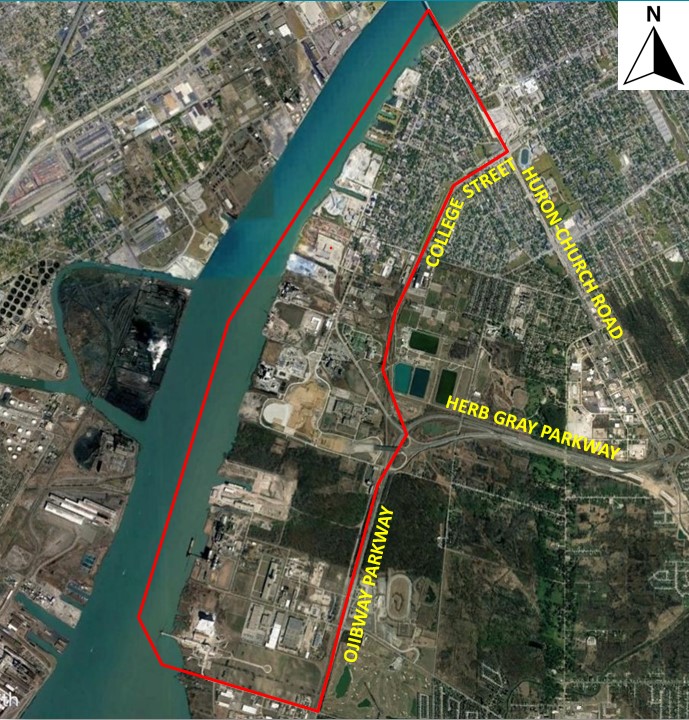
The City of Windsor undertook a flood risk assessment study to develop a flood risk profile for the West Windsor area under extreme Detroit River water levels and to identify recommended flood protection solutions. The study area is generally bounded by the Detroit River to the west, Huron Church Road and Ambassador Bridge to the north, the Essex Terminal Railway and College Street to the east, and the Town of LaSalle municipal boundary to the south, as shown on the Project Location Map.
Completed Final Report - January 2023
Virtual Public Information Centre - October 2022
The City of Windsor prepared a virtual Public Information Centre (PIC) to present the project scope and purpose, the flood risk study methodology, the effects of the flooding and flood mitigation solutions. The PIC is available at the following link:
West Windsor Flood Assessment Study - Public Information Centre (PIC) - YouTube Video.
Aojeen Issac, M. Eng., P. Eng. |
Nick Emery, P. Eng. Project Manager
Dillon Consulting Limited
130 Dufferin Avenue, Suite 1400
London, Ontario, N6A 5R2
Phone: (519) 438-1288
Email: nemery@dillon.ca |